7 Days Lemosho Route - Kilimanjaro Trekking Tour
Experience the ultimate Kilimanjaro trekking adventure with our professional 7 Days Lemosho Route tour. Expert guides, quality equipment, and guaranteed summit success.


7 Days Lemosho Route - Tour Overview
7 Days
12+
Private Tour
Mid-Range Accommodation
7 Days Lemosho Route - Detailed Overview
The Lemosho
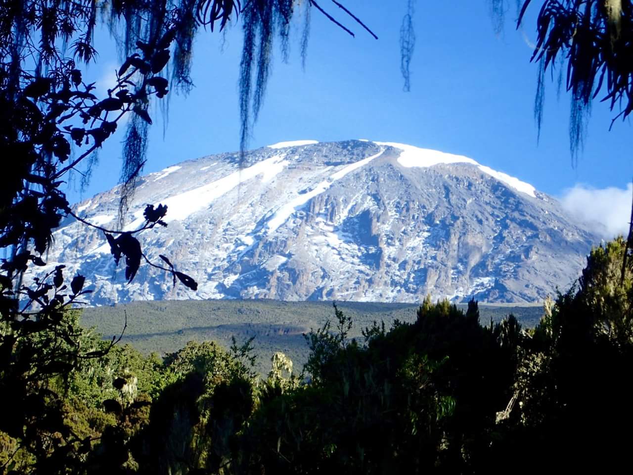
Route is one of the most scenic and rewarding ways to climb Mount Kilimanjaro,
Africa’s highest peak at 5,895 meters (19,341 feet). The 7-day itinerary offers
gradual acclimatization, increasing the likelihood of reaching the summit while
allowing trekkers to fully enjoy the diverse landscapes of Kilimanjaro National
Park.
Originating
from the remote western slopes of Kilimanjaro, the Lemosho Route is less
crowded than Machame and Marangu routes, providing a serene wilderness trekking
experience. Hikers journey through dense rainforest, moorlands, alpine desert,
and arctic summit terrain, witnessing breathtaking views of Mount Meru, Shira
Plateau, and the Great Rift Valley.
This 7-day
itinerary is ideal for adventure travelers, nature enthusiasts, and
photographers seeking a well-paced Kilimanjaro climb with spectacular scenery.
7 Days Lemosho Route - What's Included
7 Days Lemosho Route - Daily Itinerary
You will be picked up from the airport. From there you will
go to the hotel in Moshi for an orientation on your trek. Your guides will be
there to provide you with details on your trek and will also check your
trekking gear.
- Altitude: 2,100m → 2,650m
- Distance: ~6 km
- Hiking Time: 3–4 hours
- Zone: Tropical Rainforest
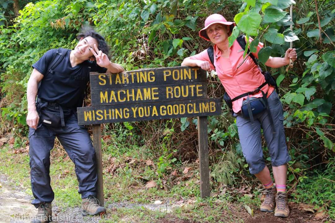
The
adventure begins at Londorosi Gate, where park registration is completed before
entering the rainforest zone of Kilimanjaro. The trail leads through dense,
untouched forest rich in biodiversity.
Expect
sightings of colobus monkeys, blue monkeys, and exotic birds as you hike along
shaded trails and small streams.
Arrival at Big
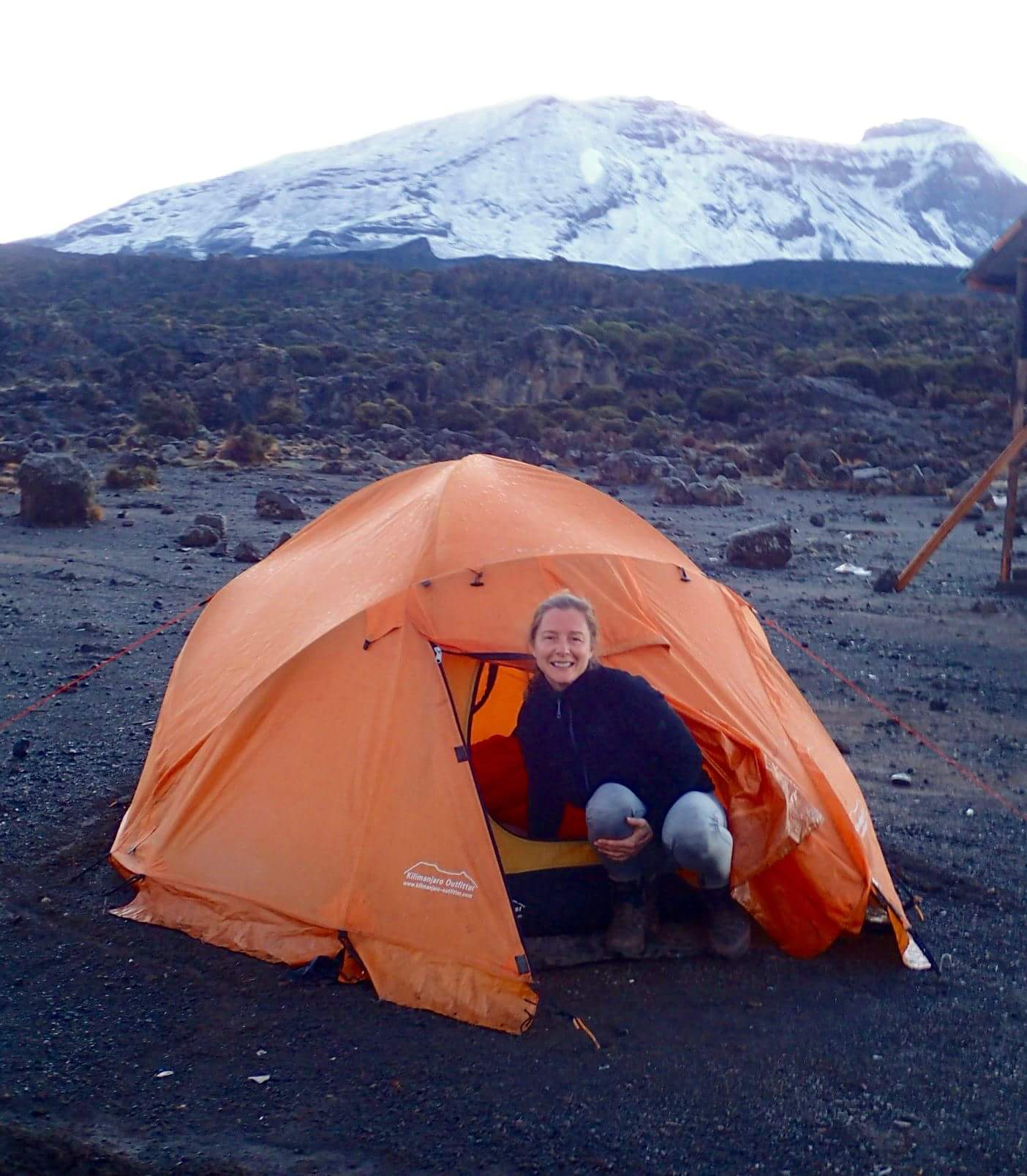
Tree Camp (Mti Mkubwa) marks your first overnight stay on the mountain.
Highlights:
- Dense rainforest trekking
- Wildlife encounters
- Peaceful and uncrowded trail
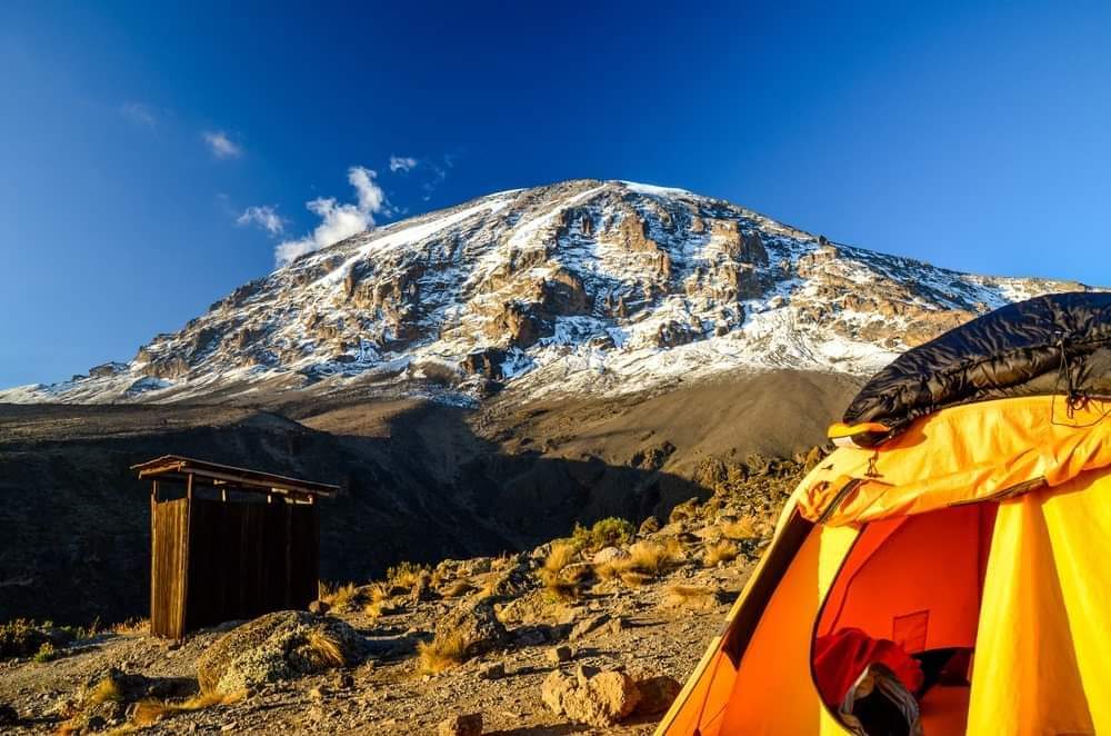
- Altitude: 2,650m → 3,850m
- Distance: 8–10 km
- Hiking Time: 5–6 hours
- Zone: Rainforest → Moorland
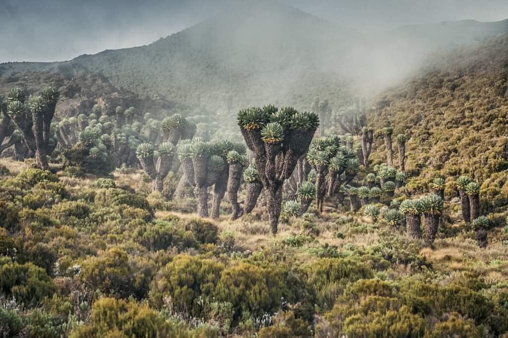
The trail climbs steadily out of the forest into the heather and moorland zone, revealing dramatic volcanic landscapes and wide-open views.
You reach the famous Shira Plateau, one of Kilimanjaro’s oldest volcanic formations. Here, trekkers enjoy panoramic views of Kibo Peak and surrounding valleys.
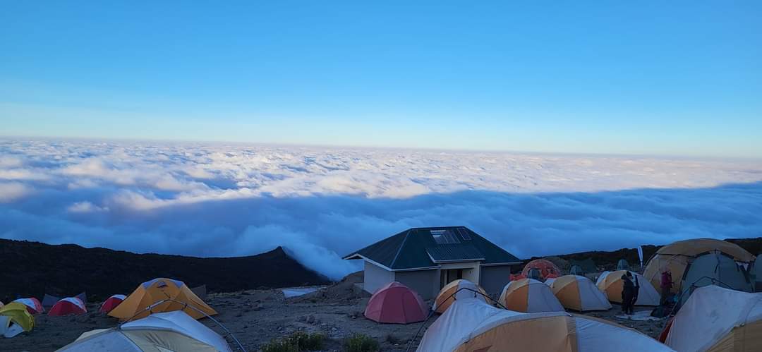
Overnight at Shira 2 Camp, a scenic and less crowded campsite.
Highlights: Shira Plateau views, volcanic scenery, first alpine landscapes
- Altitude: 3,850m → 4,630m → 3,960m
- Distance: 10–12 km
- Hiking Time: 6–7 hours
- Zone: Moorland → Alpine Desert
Today is a key acclimatization stage known as “climb high, sleep low.” The trail ascends to Lava Tower (4,630m), a dramatic volcanic rock formation.
After lunch at high altitude, the route descends to Barranco Camp, one of the most beautiful campsites on Kilimanjaro.
Highlights:
- Lava Tower acclimatization stop
- Dramatic alpine landscapes
- Barranco Valley views
- Altitude: 3,960m → 4,035m
- Distance: 5–6 km
- Hiking Time: 4–5 hours
- Zone: Alpine Desert
The day begins with the famous Barranco Wall climb, a thrilling but non-technical scramble offering incredible views of the valley below.
After the wall, the trail continues through ridges and valleys to Karanga Camp, the final water point before the summit.
Highlights:
- Barranco Wall adventure
- Panoramic ridge views
- Final acclimatization stop
- Altitude: 4,035m → 4,640m
- Distance: 4–5 km
- Hiking Time: 3–4 hours
- Zone: Alpine Desert
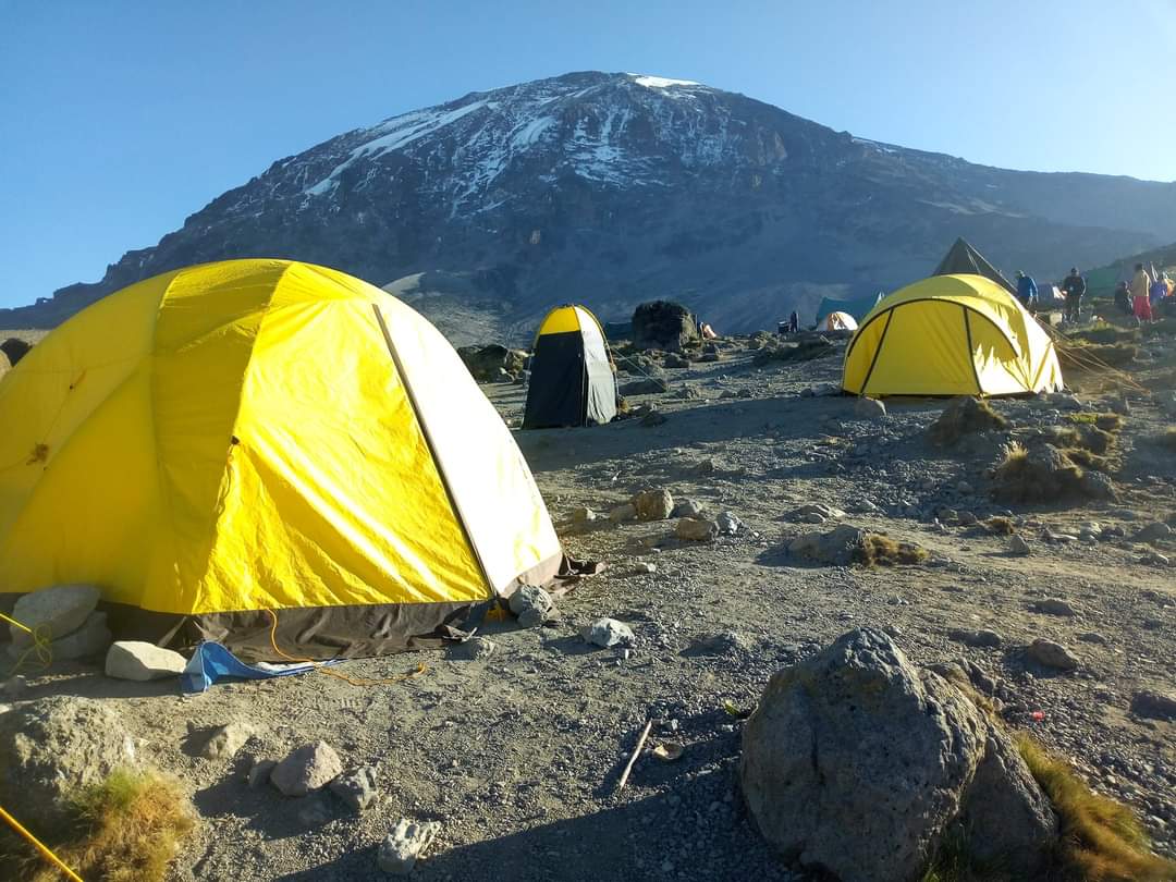
A short but important climb to Barafu Camp, the base camp for
the summit attempt. The landscape becomes dry, rocky, and extremely exposed.
Early dinner and rest are essential before the midnight
summit push.
Highlights:
- Summit preparation
- Views of Kibo and Mawenzi peaks
- Early rest before summit night
- Altitude: 4,640m → 5,895m →
3,100m
- Distance: 16–17 km
- Hiking Time: 12–14 hours
- Zone: Arctic → Rainforest
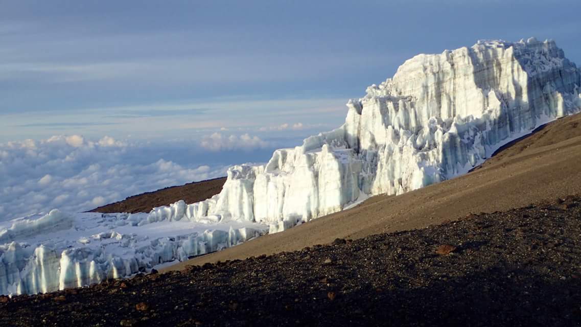
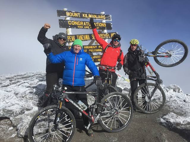
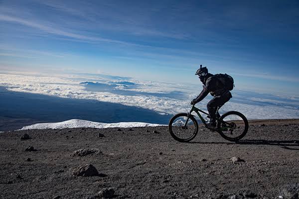
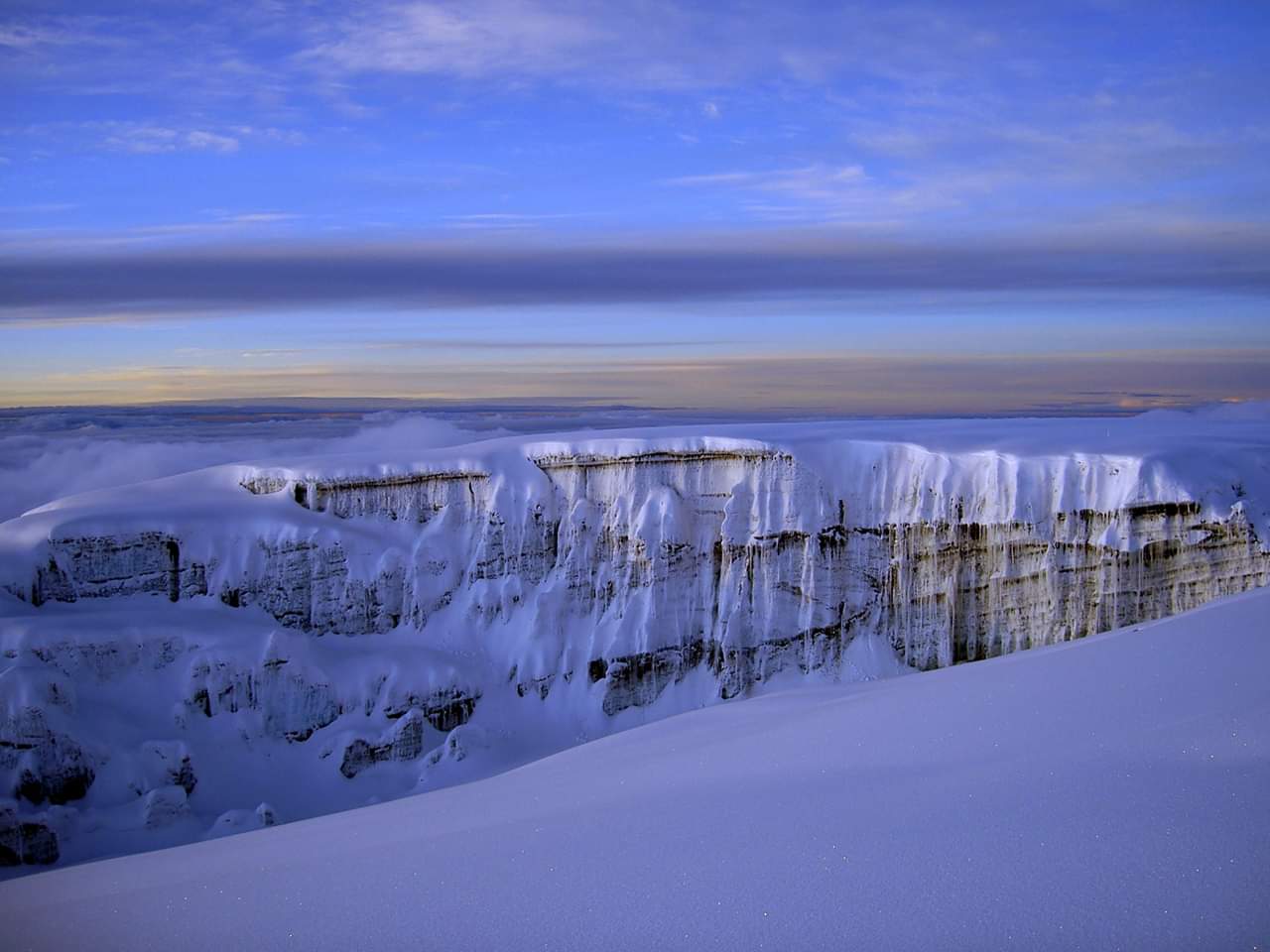
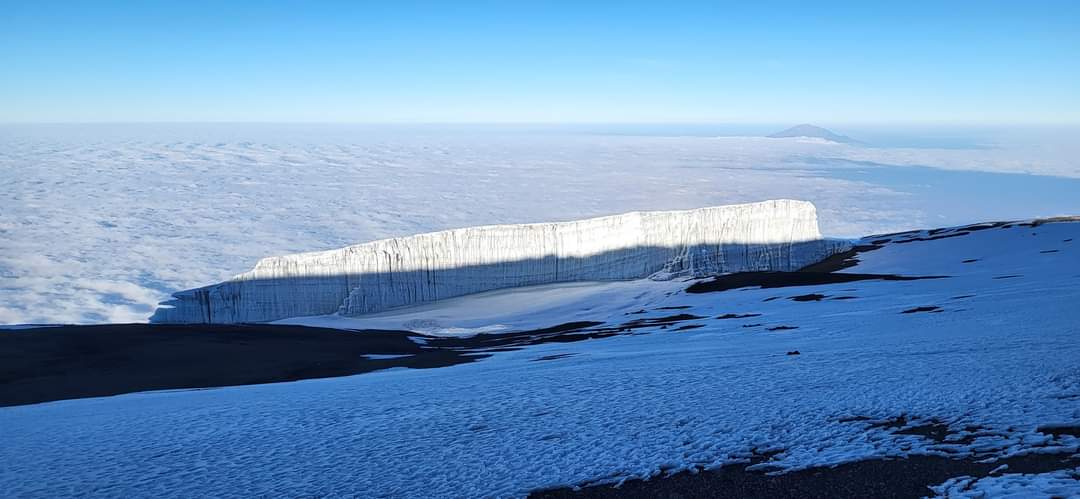
The summit
attempt begins around midnight. Climbers ascend slowly under freezing
conditions toward Stella Point (5,756m) and finally reach Uhuru Peak, the
highest point in Africa.
At sunrise,
trekkers enjoy breathtaking views above the clouds over the African continent.
After summit
celebration, the descent continues to Mweka Camp through changing ecological
zones.
Highlights:
- Uhuru Peak summit (5,895m)
- Sunrise above the clouds
- Complete ecological descent
- Altitude: 3,100m → 1,640m
- Distance: 10 km
- Hiking Time: 3–4 hours
- Zone: Rainforest
The final
descent follows a well-maintained trail through lush rainforest. The air
becomes warmer and richer in oxygen as hikers descend toward lower elevations.
At Mweka
Gate, trekkers receive their summit certificates and celebrate the completion
of the Kilimanjaro climb.
Transfer
back to hotel in Moshi or Arusha.
Highlights:
Final rainforest walk, certificate ceremony, successful summit completion
7 Days Lemosho Route - Pricing per Person
| Season | Solo | 2 Persons | 3 Persons | 4 Persons | 5 Persons | 6 Persons | 6+ Persons |
|---|---|---|---|---|---|---|---|
January to December |
$2200 | $2100 | $2050 | $1990 | $1970 | $1940 | $1910 |
Similar Kilimanjaro Trekking Tours